Henry Hudson
High School / History / Exploration
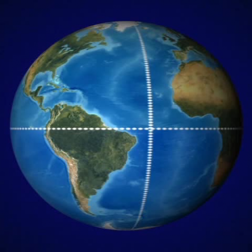
The Dutch East India Company gave Hudson an 80 ton ship called the half moon. And a crew of 20 sailors for his third attempt to find the northeast passage. In early April, 1609, Hudson headed north as expected. But once he hit the cold waters, he came up with a new plan. He would seek the northwest passage instead. He set the half moons course west instead of north. And headed to the new world and a more favorable climate. This one change of direction would make history. Hudson used several navigational methods in his quest for the northwest passage. He used maps and charts to tell him where he was and how to get to his destination. And he used longitude and latitude to map his route. Longitude runs north to south. And latitude runs east to west. These imaginary intersecting lines describe the position of any point on earth. The equator at latitude 0° divides earth into northern and southern hemispheres. The prime meridian at longitude 0° divides earth into eastern and western hemispheres. Both Asia and North America are located in the northern hemisphere. Hudson hoped to find a route to Asia along the northern coast of North America. Hudson said his course for latitude 40° north and headed for the new world. Hudson explored the northeastern coast of America. He stopped in Maine and sailed south along the coast. About 100 miles past the Chesapeake Bay. Eventually, he turned north and sailed into the mouth of a wide river in what is now New York State. This river would eventually bear his name. The Hudson River. The crew was quite excited when they first entered the river. They thought they had finally found the northwest passage. But after a 150 miles, they could travel no further. The water had become too shallow to continue. For the third time, the half moon had to turn around and head home. The river was not named after Hudson because he was the first to discover it. It was named after him because he was the first to navigate the river and leave a detailed account of his voyage. His records helped to make a more complete map of the northeastern coast, including the region known today as Albany, New York.


